Map - Mers El Kébir (Mers el Kebir)

Mers El Kébir (Mers el Kebir)
Mers El Kébir (المرسى الكبير ) is a port on the Mediterranean Sea, near Oran in Oran Province, northwest Algeria. It is famous for the attack on the French fleet in 1940, in the Second World War.

Originally a Roman port called Portus Divinus, Mers-el-Kébir became an Almohad naval arsenal in the 12th century, fell under the rulers of the Kingdom of Tlemcen in the 13th century, and eventually became a center of pirate activity around 1492. It was fought over by the Ottoman Turks, Portuguese (defeated in the 1501 Battle of Mers El Kebir by Abu Abdallah IV) and Spanish (defeated in the 1507 Battle of Mers-el-Kébir by Abu Abd Allah V), with the Spanish (who named it Mazalquivir) capturing it in 1505 under Cardinal Cisneros. Mazalquivir was the base used to capture neighbouring Oran in 1509. The Spanish held both cities until 1708, when they were driven out by Bey Mustapha Ben Youssef (also known as Bouchelaghem). The Spanish returned in 1732 when the armada of the Duke of Montemar was victorious in the Battle of Aïn-el-Turk and again took Oran and Mazalquivir. Both cities were held until 1792, when they were sold by King Carlos IV to the Dey of Algiers following a siege by the forces of the Dey. The French occupied it in 1830, and renamed it Saint André de Mers-el-Kébir, enhancing the port in 1868 with an eponymous lighthouse; the latter was destroyed in World War II.

 
Map - Mers El Kébir (Mers el Kebir)
Map
Google Earth - Map - Mers El Kébir
Google Earth
Openstreetmap - Map - Mers El Kébir
Openstreetmap
Map - Mers El Kébir - Esri.WorldImagery
Esri.WorldImagery
Map - Mers El Kébir - Esri.WorldStreetMap
Esri.WorldStreetMap
Map - Mers El Kébir - OpenStreetMap.Mapnik
OpenStreetMap.Mapnik
Map - Mers El Kébir - OpenStreetMap.HOT
OpenStreetMap.HOT
Map - Mers El Kébir - CartoDB.Positron
CartoDB.Positron
Map - Mers El Kébir - CartoDB.Voyager
CartoDB.Voyager
Map - Mers El Kébir - OpenMapSurfer.Roads
OpenMapSurfer.Roads
Map - Mers El Kébir - Esri.WorldTopoMap
Esri.WorldTopoMap
Map - Mers El Kébir - Stamen.TonerLite
Stamen.TonerLite
Country - Algeria
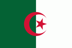
Flag of Algeria
Algeria, officially the People's Democratic Republic of Algeria, is a country in North Africa. Algeria is bordered to the northeast by Tunisia; to the east by Libya; to the southeast by Niger; to the southwest by Mali, Mauritania, and Western Sahara; to the west by Morocco; and to the north by the Mediterranean Sea. It is considered part of the Maghreb region of North Africa. It has a semi-arid geography, with most of the population living in the fertile north and the Sahara dominating the geography of the south. Algeria covers an area of 2381741 km2, making it the world's tenth largest nation by area, and the largest nation in Africa, being more than 200 times as large as the smallest country in the continent, The Gambia. With a population of 44 million, Algeria is the ninth-most populous country in Africa, and the 32nd-most populous country in the world. The capital and largest city is Algiers, located in the far north on the Mediterranean coast.

Algeria produced and is linked to many civilizations, empires and dynasties, including ancient Numidians, Phoenicians, Carthaginians, Romans, Vandals, Byzantines, Umayyads, Abbasids, Rustamids, Idrisids, Aghlabids, Fatimids, Zirids, Hammadids, Almoravids, Almohads, Zayyanids, Spaniards, Ottomans and the French colonial empire, with the latter expanded into its present-boundaries. After 132 years of being part of France, tensions between France and the local Algerian populace led to the start of the Algerian War which concluded with Algeria obtaining its independence on 5 July 1962 with the establishment of the People's Democratic Republic on 20 September of that year.
Currency / Language  
ISO Currency Symbol Significant figures
DZD Algerian dinar دج 2
ISO Language
AR Arabic language
Neighbourhood - Country  
  •  Libya 
  •  Mali 
  •  Mauritania 
  •  Morocco 
  •  Niger 
  •  Tunisia 
  •  Western Sahara